

Coomacloghane [Com an Chlochain]
Good walks are even better shared.
Overview
Coomacloghane [Com an Chlochain]
Coomacloghane, standing tall at 746 meters, is a proud participant in the stunning MacGillycuddy's Reeks range, located in County Kerry, Ireland. Its striking profiles and rich geology make it a must-visit for hikers looking to experience the charm of Irish mountains.
Geology
The mountain is primarily formed from granite, which has weathered over millennia due to glacial activity. This has resulted in the steep climbs and wonderful geological features that attract outdoor lovers. Don’t worry when you see the rocky paths; they are as much part of the adventure as reaching the top!
Routes
The most popular route to the summit starts from the Gap of Dunloe. This picturesque pathway is around 10 km in length and typically takes about 4 hours to complete. Expect a moderate level of difficulty with some fabulous views along the way. Just remember, no one wants to be caught on the mountain after dark, unless you’ve got a good collection of ghost stories!
Summit Features
When you finally reach the top, a sturdy cairn awaits you, a perfect place to sit back, relax, and soak in the views while contemplating whether that last slice of cake was worth the hike.
Terrain
The terrain of Coomacloghane varies with rocky paths and soft grassy slopes. Despite its beauty, you'll want to keep your footing, especially when navigating the boggy sections that can surprise you with a splash!
Views
From the summit, behold breathtaking vistas of the surrounding peaks including Carrauntoohil, Ireland's highest mountain. The views are especially magical in Spring and Autumn when the landscape bursts into vibrant colours. A photo-op here is mandatory, if only to prove you actually made it all the way up!
Hazards
While the mountain is stunning, be prepared for quickly changing weather conditions typical of this region. The rocky terrain can become slippery when wet, so tread carefully; we wouldn’t want anyone doing a dramatic slide down the mountain!
Nearby Summits
If you're up for more adventure, consider visiting nearby summits like Carrauntoohil (1038 m) and Beenkeragh (1010 m). Each offers its unique charm and challenges.
Access
The nearest parking is conveniently located at the Gap of Dunloe Visitor Centre, about 3 km from the trail starting point. Public transport is also available, with buses running from Killarney. If you’re in town, Killarney offers plenty to explore before or after your hike!
Facilities
Post-hike, treat yourself at one of the lovely cafes at the Gap of Dunloe where you can replenish those calories lost during the climb! Toilets are also available nearby, so no need to fret about the little things.
History
The name ‘Com an Chlochain’ refers to 'the hill of the stone', honoring the natural terrain that defines this remarkable mountain. Its significance not only lies in its beauty but also in its cultural ties to the local heritage, making it a popular destination both for tourists and locals seeking a taste of the great outdoors.
In conclusion, Coomacloghane is a gem that embodies the spirit of outdoor adventure in Ireland. So pack your gear, wear those hiking boots, and enjoy the wonders of nature, one summit at a time!
Last Updated
2023-10-02
Explore routes near Coomacloghane [Com an Chlochain]
Public walks starting within 80 km of this hill. Nearby does not mean a route reaches the summit; check its map and access before setting out.
No public routes are currently listed within 80 km of Coomacloghane [Com an Chlochain] on Walkmates. This does not mean there are no paths here. Explore the map and check local access information before planning a walk.
Route planning notes
These notes describe possible approaches, not verified navigable routes or permission to cross land. Check current paths, local access rules and conditions before setting out.
Coomacloghane from Gap of Dunloe
A popular route starting from the scenic Gap of Dunloe. The path meanders through beautiful landscapes with panoramic views, making it a favourite among hikers.
Make a day of it, together
Find someone to share the walk with, or organise a day out along a route you like.
Photo Gallery
View all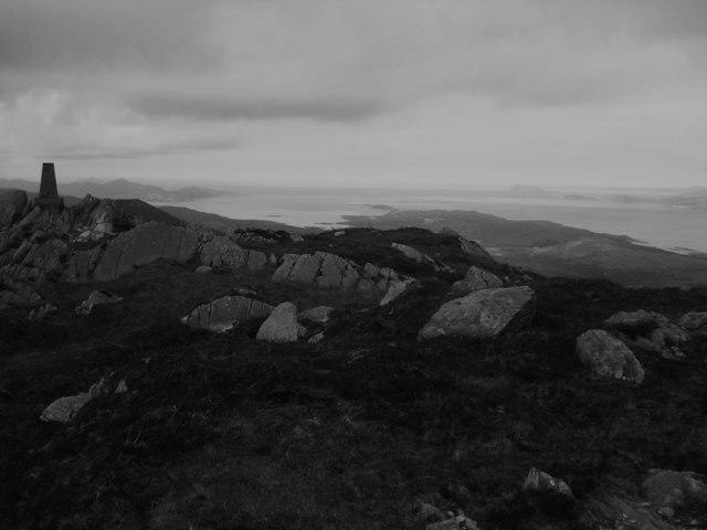 Photo could not load
V7354 : Coomacloghane Mountain
Keith Cunneen
Hill facts and local notes
Classifications
Elevation
599m
1,965 ft
Prominence
105m
Coordinates
51.7319, -9.8351
V732548
OS Map
84
At the Summit
At the summit, hikers will find a well-constructed cairn offering a perfect spot for a well-deserved rest and some photo opportunities.
Terrain & Geology
Coomacloghane is primarily composed of granite, characteristic of the rugged landscape of the MacGillycuddy's Reeks. Its formation includes glacial deposits that shape the dramatic contours of the mountain.
Views & Scenery
Outstanding views of the surrounding mountains, including Carrauntoohil, and the beautiful lakes of Killarney National Park.
History & Heritage
Name Origin
The name Com an Chlochain translates to 'the hill of the stone', relating to its rocky features.
Historical Significance
Coomacloghane is an important part of the local heritage and is frequently visited by both locals and tourists keen to experience and connect with the natural beauty of County Kerry.
Getting There & Facilities
Check current local access restrictions, parking rules and transport timetables before travelling. These notes do not confirm public access to the summit.
Parking
Parking is available at the Gap of Dunloe Visitor Centre, which is approximately 3 km from the trailhead.
Public Transport
Buses run from Killarney to the Gap of Dunloe, making it reasonably accessible for those without a car.
Nearby Facilities
There are cafes and public toilets at the Gap of Dunloe, which are excellent for a post-hike snack or refreshment.
Safety Information
Known Hazards
- Be mindful of sudden weather changes typical of the region; rocky terrain may be slippery when wet.
General Safety Tips
- Check weather conditions before setting out
- Carry appropriate clothing and equipment
- Let someone know your planned route
- Take a map, compass, and GPS device
- Carry emergency supplies: food, water, first aid kit, torch
Hills
Some common questions about the hills answered
Are there group walks up Coomacloghane [Com an Chlochain]?
Many walkers use Walkmates to join or organise walks with others. You can check for group walks around Coomacloghane [Com an Chlochain] through the maps
Are there other walkers around Coomacloghane [Com an Chlochain]?
Activity varies by location and time, but Walkmates lets you see whether others have shared walks or shown interest in this area. Find other people through the walking friends search walking friends for Coomacloghane [Com an Chlochain] search or of course create your own walk for Coomacloghane [Com an Chlochain]
Can I organise a walk to Coomacloghane [Com an Chlochain]?
Yes. If there aren’t any walks listed already, you can create a walk and make it available for others to join.
If you're signed up to Walkmates, you can create a walk to Coomacloghane [Com an Chlochain].
How do I find a walk up this hill?
There are often multiple ways to walk this hill, depending on experience and route preference. Walkmates helps you explore walks and routes that others have shared.
Can I suggest a new route up Coomacloghane [Com an Chlochain]?
Yes. You can suggest or create routes to share with others. Walkmates focuses on the social side of walking, so routes are used to help people organise walks and explore areas together, rather than as detailed navigation tools or route libraries.
Other uses really appreciate knowledgeable walkers sharing their routes. Share your favourite route to Coomacloghane [Com an Chlochain] here
The is an error or something incorrect about this hill. How do I let you know?
We always strive to keep the information on Walkmates as accurate as possible. If you find an error, please let us know through the contact form and we'll aim to correct it as quickly as possible
Community Discussion
Comments
Location
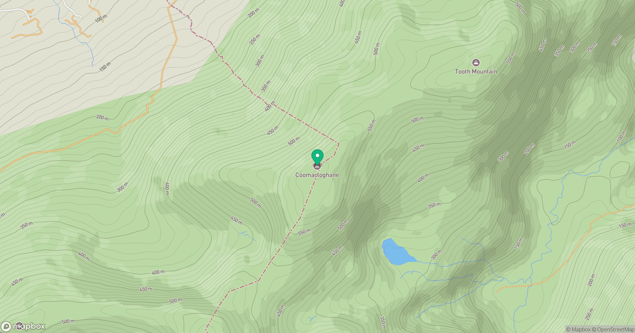
Grid reference: V732548
View on OpenStreetMapOpens a map in a new tab, centred on the hill.
Hills within 30 km
Straight-line distance, not a walking route or confirmation of access.
Eskatarriff [Eisc an Tairbh]
600m
Lackabane [Leaca Bhan]
603m
Knocknagree [Cnoc na Groi]
586m
Maulin [Malainn]
621m
Hungry Hill [Cnoc Daod]
685m
No comments yet. Be the first.